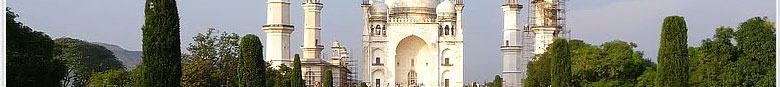
Aurangabad District is situated mainly in Godavari Basin and its some part towards North West of Tapi River Basin. The Aurangabad districts North Longitude ( Degree) is 19 and 20 and East Longitude (Degree ) is 74 to 76.
AREA
The Aurangabad Districts total area is 10,100 Sq. Kilo Mtrs.
FORESTS
In Aurangbad district total Forest Area is 135.75 Sq.Km.
MOUNTAINS
There are four mountains namely
1) Antur : its height is 826 Mtr.
2) Satonda : 552 Mtr.
3) Abbasgad : 671 Mtrs
4) Ajintha 578 Mtrs. Average Height of Southern portion is 600 to 670 mtrs.
RIVER
The main rivers are Godavari and Tapi and also Purna, Shivna, Kham . Dudhna, Galhati and Girja rivers are the sub rivers of Godavari.
CLIMATE
Rainy season begins from the month of June to September. Winter Season is from October to February and March to May is the season of Summer. The Average rain fall of Aurangabad District is 734 mm and the Minimum Temperature is 5.6°C. Mximum Temperature is 45.9°C.
LANGUAGES
Marathi, Hindi, English and Urdu language. |